NDVI Turf Health Monitoring
NDVI — Normalized Difference Vegetation Index — is the most effective aerial tool available for identifying turf stress before it becomes visible to the naked eye. Using multispectral sensors on the DJI Mavic 3 Enterprise, we capture near-infrared and visible red light data across every square foot of your course. The resulting NDVI map assigns a color-coded health value to each area of turf, making it immediately clear where conditions are optimal and where intervention is needed.
For Florida golf courses, NDVI turf mapping is particularly valuable because of the unique pressures the subtropical climate places on turfgrass. Summer heat stress, afternoon thunderstorms, high humidity fostering fungal diseases like dollar spot and brown patch, and saltwater intrusion in coastal areas all create conditions where turf can decline rapidly. Monthly NDVI monitoring detects these issues in their earliest stages — often a week or more before they become visible — giving superintendents the window they need to apply targeted treatments rather than reactive broadcast applications.
The practical result is reduced chemical usage, lower treatment costs, and turf that stays healthier through Florida's most demanding growing months. Each NDVI flight produces a georeferenced vegetation health map that can be viewed on a tablet in the field, printed for the maintenance shop, or loaded into GIS software for overlay analysis with irrigation zones and soil sample data.
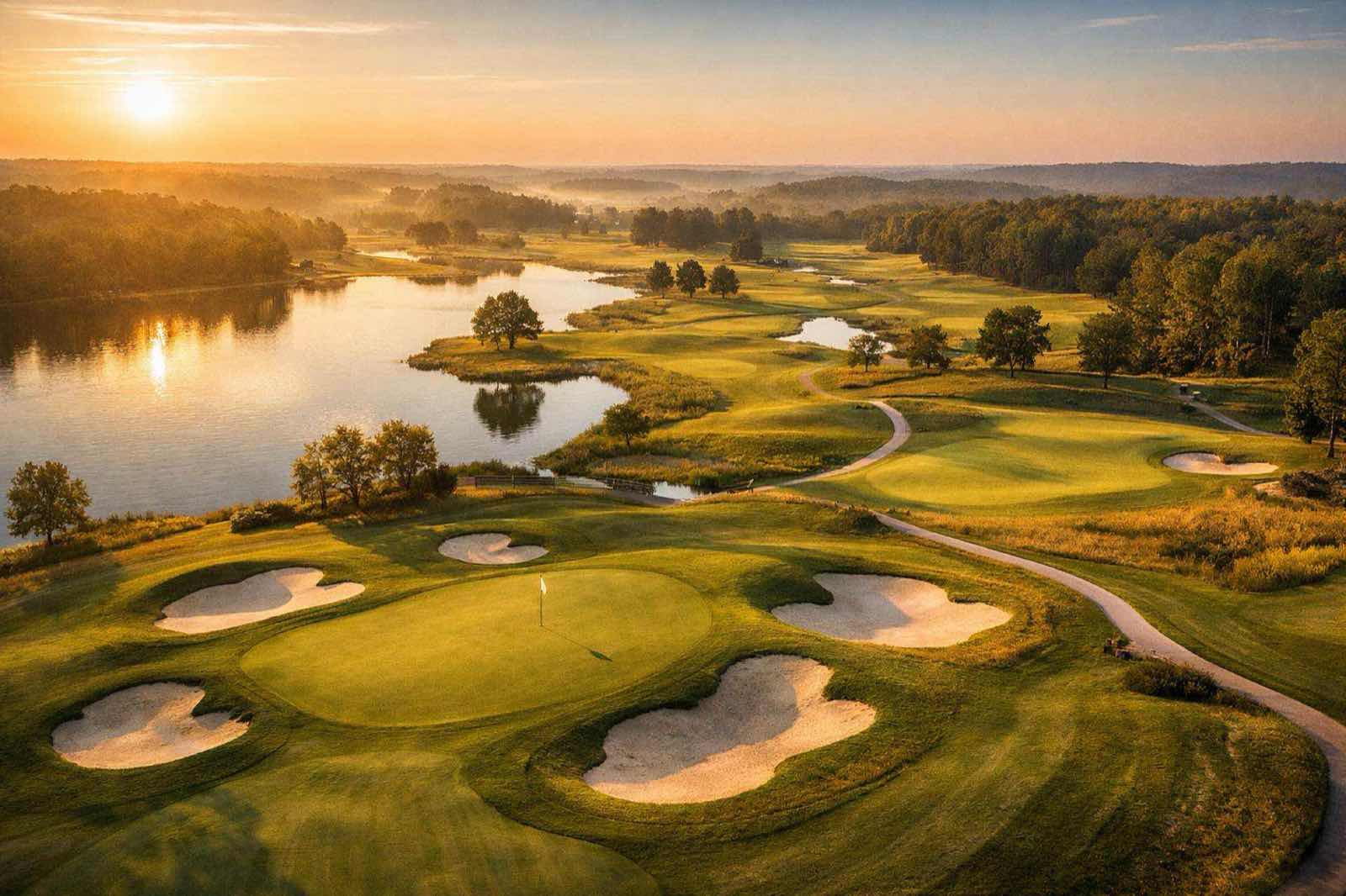
Elevation Contours & Drainage Analysis
Water management is the foundation of turf health on any Florida golf course. Our drone mapping produces detailed elevation contour models that reveal the micro-topography of your course — subtle grade changes that influence where water pools, how irrigation distributes, and where drainage infrastructure may be underperforming.
These elevation models are generated from the same photogrammetry flights used for NDVI and orthomosaic mapping, so they add no additional flight time or cost to a monthly program. Superintendents use the contour data to adjust irrigation heads, plan drainage improvements, and verify that grading changes during renovation projects are achieving the intended results. In Florida's flat terrain, even a few inches of elevation difference can mean the difference between a well-drained fairway and a chronically wet area that fosters disease and root decline.
Monthly Flight Programs
Our monthly golf course drone program is designed for superintendents who want consistent, comparable data across every growing season. At $2,500 per month, the program includes one full-course flight per month with the following deliverables:
- Full-course NDVI vegetation health map with color-coded stress indicators
- Updated high-resolution orthomosaic basemap of the entire property
- Elevation contour overlay with drainage analysis annotations
- Month-over-month change report highlighting areas of improvement and decline
- Cloud-hosted dashboard with historical data for trend analysis
The monthly cadence builds a longitudinal dataset that becomes more valuable over time. After six months, you can compare turf health across seasons. After a full year, you have a complete picture of how your course responds to Florida's wet season, dry season, and the transition periods in between. This data supports budgeting decisions, renovation planning, and agronomic program adjustments with real evidence rather than visual estimation.
Aerial Marketing Photography for Golf Courses
Beyond turf management data, our drone platform also captures stunning aerial photography and video for course marketing. Showcase signature holes, clubhouse views, and the full layout of your course from perspectives that ground-level photography simply cannot achieve. These assets are used by courses across Florida for website headers, social media content, tournament promotion, and membership marketing materials.
If your course is already on a monthly flight program, marketing photography can be added to any scheduled flight at a reduced rate. For standalone marketing shoots, see our aerial photography and video services.
Why Florida Golf Courses Choose Drone Data
Florida's golf market operates under conditions that no other state matches. The combination of year-round play, subtropical heat, afternoon convection storms, high humidity, sandy soils, and saltwater table proximity creates a turf management environment where precision matters more than anywhere else in the country. Bermudagrass greens and paspalum fairways require constant monitoring, and the margin between healthy turf and a stressed playing surface can be measured in days during peak summer.
Drone NDVI data gives superintendents an objective, repeatable measurement tool that removes guesswork from the management equation. It pairs directly with soil sampling, weather station data, and irrigation system analytics to create a complete picture of course conditions. Courses that adopt monthly drone monitoring consistently report faster identification of irrigation system failures, earlier detection of disease pressure, and more efficient allocation of labor and chemical budgets.